EarthDefine launches Buildings Footprints 3D API, bringing structure-level geospatial intelligence to developers nationwide
PR Newswire
REDMOND, Wash., Aug. 6, 2026
REDMOND, Wash., Aug. 6, 2026 /PRNewswire/ -- EarthDefine, a provider of high-resolution geospatial products, announced the launch of its Buildings Footprints 3D API, giving developers and enterprises programmatic access to detailed building footprint and structure data across the United States.
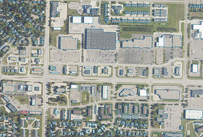
Building footprint data is foundational to a wide range of applications, from insurance underwriting and property assessment to logistics, urban planning, and location intelligence. Teams running analysis across the full national dataset have traditionally licensed it in bulk, with data refreshed on EarthDefine's quarterly cycle. Many applications need something different: individual buildings, delivered the moment a user requests them. The Buildings Footprints 3D API serves that case directly, delivering structure-level data on demand through a REST-based interface with predictable, resource-oriented URLs and standard HTTP conventions.
The API provides:
- Instant access to over 200 million building footprints spanning the country.
- Over 274 million high-fidelity address points mapped directly to structures for exceptional geocoding accuracy
- High-precision data including building heights, ground elevations, and total building volume. Additional derived attributes like story counts and gross area also available
- Average response times under 100ms
- On-demand querying by address, coordinate, or bounding area
- Integration-ready JSON output for GIS platforms, insurance models, and enterprise applications
"The data behind the API is the same data we license in bulk, refreshed on our regular quarterly cycle, with a full national pass every two years," said Vikalpa Jetly, CEO of EarthDefine. "What changes is how you reach it: predictable REST endpoints, JSON responses, and no learning curve, so your applications can pull the freshest available data the moment they need it."
EarthDefine has already begun working with enterprise clients, including in the buildings and property intelligence space, to integrate the API into production workflows. Developers can test the API directly through EarthDefine's live playground at www.earthdefine.com/api, with full documentation and FAQs available at www.earthdefine.com/api/docs. Packages are available starting at $750 for 5,000 API calls, valid for one year from purchase or until the call limit is reached, with volume discounts available for larger deployments. Bulk licensing of the full national dataset remains available directly through EarthDefine, as well as through its network of reseller partners, for teams running large-scale analysis. Contact EarthDefine for bulk pricing.
"This is the first step in making our full geospatial catalog available through on-demand APIs," Jetly continued. "Buildings data was the natural starting point given how many downstream applications depend on it."
EarthDefine plans to expand the Buildings Footprints 3D API with additional endpoints and structure-level attributes throughout 2026, continuing its work to make high-resolution geospatial data accessible on demand.
To try the API or request a sample dataset, visit http://www.earthdefine.com/api or contact Aneetha Jayaraman at data@earthdefine.com or 1.800.579.5916.
About EarthDefine
EarthDefine is focused on transforming earth sensor data into consumable geospatial information products for numerous applications in the private and government sectors. We deploy image processing workflows that exploit advancements in computer vision and artificial intelligence (AI) to extract ground cover information from aerial imagery and other sensor data. To learn more please visit: www.earthdefine.com

 View original content to download multimedia:https://www.prnewswire.com/news-releases/earthdefine-launches-buildings-footprints-3d-api-bringing-structure-level-geospatial-intelligence-to-developers-nationwide-302845357.html
SOURCE EarthDefine LLC
